Residential Land for Sale in Pirtleville, Arizona
W Palm Ave Pirtleville, AZ 85626
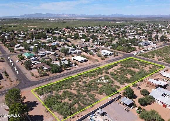


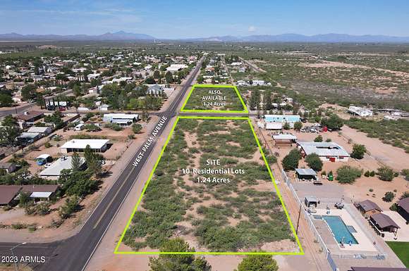


One of two sister parcels, each a full ten-lot residential block with utilities totaling 1.24 acres in the heart of Pirtleville. This is the east lot, Pirlte Lots 1-10, Block 35. Parcels are just a couple blocks west of Faras Elementary. Very unique opportunity for infill development! Great potential to create multiple home sites or a single residence with lots of room to spread out. R-9 Zoning allows for all kinds of potential uses including single and multi-family housing, churches, residential care homes, recreational facilities and more. Buyer to verify all utilities and suitability for their development and use.
Directions
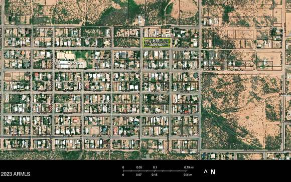
Two blocks east of Faras Elementary School in Pirtleville. Lots are on north side of road between Calle del Laurel & Camino Pinon. GPS Coordinates: 31.361552, -109.564542
Property details
- County
- Cochise County
- School District
- Douglas Unified District
- Zoning
- R-9
- Elevation
- 3,980 feet
- MLS Number
- ARMLS 6600551
- Date Posted
Parcels
- 408-20-273
Property taxes
- 2022
- $499
Nearby schools
| Name | Level | District | Description |
|---|---|---|---|
| Faras Elementary School | Elementary | Douglas Unified District | — |
| Ray Borane Middle School | Middle | Douglas Unified District | — |
Listing history
| Date | Event | Price | Change | Source |
|---|---|---|---|---|
| July 16, 2024 | New listing | $75,000 | — | ARMLS |