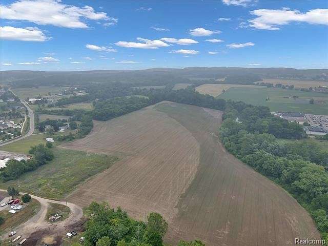
Agricultural Land for Sale in Dundee, Michigan
Stowell Rd Dundee, MI 48131

Don't miss out on the beautiful 42 acre parcel of vacant land, currently used as farmland but could hold a lot of development potential! With almost 3,000 feet of frontage along the River Raisin this land inside the village limits is sure to impress.
Subject to final approval by the township to split the land from the current property.
Directions
East of Main and South of Stowell
Location
- Street Address
- Stowell Rd
- County
- Monroe County
- Community
- Dundee TWP
- School District
- Dundee
- Elevation
- 663 feet
Property details
- Zoning
- Agricultural
- MLS Number
- REALCOMP 20230073682
- Date Posted
Parcels
- 580411802100
Legal description
* SEC 18 T6S R7E 46.66 AC COM 16.5 FT N 89 DEG 30'E & 660 FT S 0 DEG 32'W FR INT OF CL OF MAIN ST WIT E CORPORATION LI OF VILLAGE OF DUNDEE TH S 0 DEG 32'W830 FT MOL TO N'LY BANK OF RIVER RAISIN TH ALG N'LY BANK OF RIVERN 68 DEG 10'E 290 FT TH N 57 DEG 30'E 450 FT TH N 61 DEG E 300 FTTH N 81 DEG 25'E 410 FT TH N 83 DEG E 320 FT TH N 51 DEG E 200 FTTH N 38 DEG 25'E 305 FT TH N 12 DEG E 200 FT TH N 150 FT TH N 89 DEG W 1150 FT TH N 750 FT TO CL OF STOWELL RD TH S 41 DEG 25'W 650 FT TH N 89 DEG W 100 FT TH S 0 DEG 32'W 660 FT TH S 89 DEG 30'W 396 FT TO POB DESC FOR TAX PURPOSES ONLY* SEC 18 T6S R7E 46.66 AC COM 16.5 FT N 89 DEG 30'E & 660 FT S 0 DEG 32'W FR INT OF CL OF MAIN ST WIT E CORPORATION LI OF VILLAGE OF DUNDEE TH S 0 DEG 32'W830 FT MOL TO N'LY BANK OF RIVER RAISIN TH ALG N'LY BANK OF RIVERN 68 DEG 10'E 290 FT TH N 57 DEG 30'E 450 FT TH N 61 DEG E 300 FTTH N 81 DEG 25'E 410 FT TH N 83 DEG E 320 FT TH N 51 DEG E 200 FTTH N 38 DEG 25'E 305 FT TH N 12 DEG E 200 FT TH N 150 FT TH N 89
Listing history
| Date | Event | Price | Change | Source |
|---|---|---|---|---|
| Aug 31, 2023 | New listing | $525,000 | — | REALCOMP |