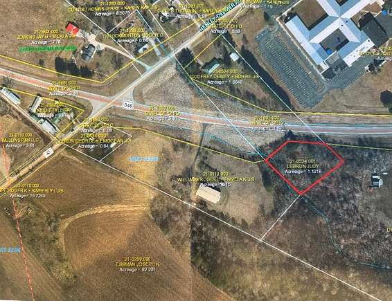
Residential Land for Sale in Lucasville, Ohio
State Route 348 Lucasville, OH 45648
Image
Map
Street
$35,000
1.13 acres
pending saleUnder contract
Nice piece of land on SR 348. In the Northwest School District and very close to the Northwest schools.
Property details
- County
- Scioto County
- Elevation
- 735 feet
- MLS Number
- GPABR 150698
- Date Posted
Parcels
- 21-0524.001
Property taxes
- Year not provided
- $75
Listing history
| Date | Event | Price | Change | Source |
|---|---|---|---|---|
| June 19, 2024 | Under contract | $35,000 | — | GPABR |
| Apr 19, 2024 | Listing removed | $35,000 | — | — |
| Apr 14, 2024 | New listing | $35,000 | — | GPABR |
Payment calculator
Lisa Buckler
Rutman Burnside Realty Group
Contact listing agent
By submitting, you agree to the terms of use, privacy policy, and to receive communications.