Agricultural Land for Sale in Pryor, Oklahoma
NW 530 Rd Pryor, OK 74361
Images
Map
![27.5 Acres of Agricultural Land for Sale in Pryor, Oklahoma](https://cdn.landsearch.com/listings/4Btjm/large/pryor-ok-122654815.jpg)
![Property](https://cdn.landsearch.com/listings/4Btjm/small/pryor-ok-122654816.jpg)
![Property](https://cdn.landsearch.com/listings/4Btjm/small/pryor-ok-122654817.jpg)
![Property](https://cdn.landsearch.com/listings/4Btjm/small/pryor-ok-122654818.jpg)
![Property](https://cdn.landsearch.com/listings/4Btjm/small/pryor-ok-122654819.jpg)
![Property](https://cdn.landsearch.com/listings/4Btjm/small/pryor-ok-122654820.jpg)
![Property](https://cdn.landsearch.com/listings/4Btjm/small/pryor-ok-122751865.jpg)
![Property](https://cdn.landsearch.com/listings/4Btjm/small/pryor-ok-122751866.jpg)
![Property](https://cdn.landsearch.com/listings/4Btjm/small/pryor-ok-122751867.jpg)
![Property](https://cdn.landsearch.com/listings/4Btjm/small/pryor-ok-122751868.jpg)
![Property](https://cdn.landsearch.com/listings/4Btjm/small/pryor-ok-122751869.jpg)
![Property](https://cdn.landsearch.com/listings/4Btjm/small/pryor-ok-122751870.jpg)
![Property](https://cdn.landsearch.com/listings/4Btjm/small/pryor-ok-122751871.jpg)
![Property](https://cdn.landsearch.com/listings/4Btjm/small/pryor-ok-122751872.jpg)
![Property](https://cdn.landsearch.com/listings/4Btjm/small/pryor-ok-122763169.jpg)
![Property](https://cdn.landsearch.com/listings/4Btjm/small/pryor-ok-122763170.jpg)
![Property](https://cdn.landsearch.com/listings/4Btjm/small/pryor-ok-122654815.jpg)
$247,500
27.5 acres
Active sale agoEst $2,035/mo
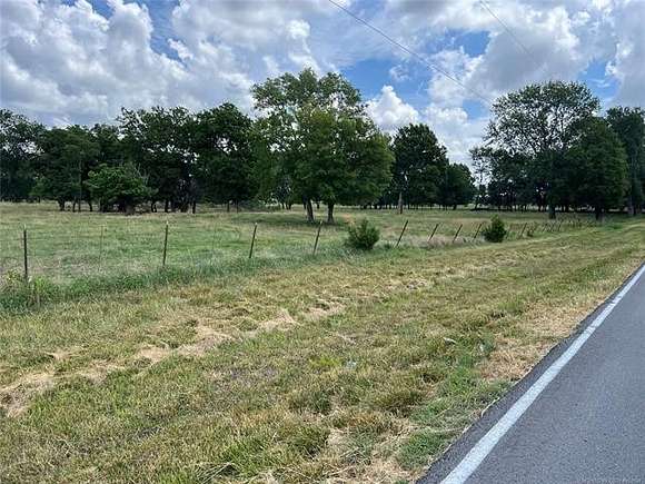
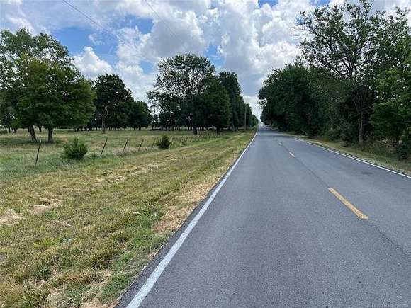
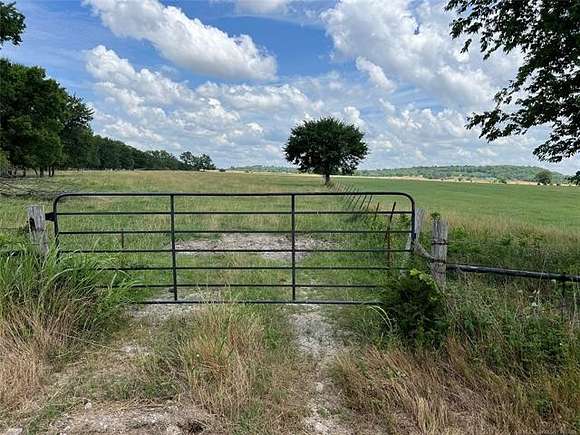
PROBERTY IS 604 FT. WIDE BY 1987 FT. DEEP, HAS A WET WEATHER CREEK, FULLY FENCED AND A POND ABOUT IN THE MIDDLE OF THE LAND. FLAT LAND WITH SOME TREES, MOSTELY PASTURE LAND.
LAND IS ABOUT 4.25 MILES WEST OF HWY 69 AND 69A, VERY CLOSE TO THE INDUSTRIAL PARK.
PLEASE SEE THE DOCUMENTS FOR MAPS
Directions
West of chouteau on hwy 412, turn North on 427 rd. about 5 miles to 530 rd. turn West about 100 yd. to sign, or from hwy 69 go West on 530 rd(west at 69A) about 4.25 miles to property on the North side of road, or from hwy 20, between Claremore and Pryor, turn South on 426 rd. to 530 ( at curve in road) turn east at curve about 1/4 mile to property on the north side. Look for sign.
Property details
- County
- Mayes County
- Zoning
- IP
- Elevation
- 650 feet
- MLS Number
- NORES 2421995
- Date Posted
Legal description
SEC 32-21-18 W 110' OF S 1980' W2SE - E 495' OF S 1980' E2SW 595/330
Detailed attributes
Listing
- Type
- Lots And Land
Lot
- Features
- Pond
Listing history
Date | Event | Price | Change | Source |
---|---|---|---|---|
June 21, 2024 | New listing | $247,500 | — | NORES |
Payment calculator
Contact listing agent
By submitting, you agree to the terms of use, privacy policy, and to receive communications.