Images
Map


Residential Land for Sale in Burns, Oregon
N Imperial Ave, Burns, OR 97720
$65,000
6.57 acres
Active
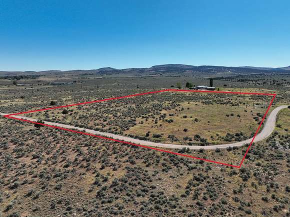
Est $490/mo6+/- Acres - N Imperial Ave, Burns
Located near Slater Elementary School, Harney District Hospital, & other amenities, this lot provides elbow room & a significant amount of space for being in Burns City Limits. The lot has gravel access off a paved city road & has partial fencing with existing rock jacks that could be utilized.
Contact the listing brokers or City of Burns for information in regard to building, utilities, & further information.
LOT: 23S30E12-AC-00201
LOT SIZE: 6.57 acres (+/-)
TAXES: $468.28 (2023 Tax Year Before Property Line Adjustment)
FINANCES: Cash or Bank Financing
Location
- Street address
- N Imperial Ave
- County
- Harney County
- Elevation
- 4,245 feet
Property details
- Acreage
- 6.57 acres
- Posted
Parcels
- 1323.00S30.00E12AC--000000201
Listing history
| Date | Event | Price | Change | Source |
|---|---|---|---|---|
| Jan 7, 2026 | Relisted | $65,000 | — | Listing agent |
| Jan 2, 2026 | Listing removed | $65,000 | — | Listing agent |
| Feb 19, 2025 | Price increase | $65,000 | $10,000 18.2% | Listing agent |
| Jan 4, 2025 | Relisted | $55,000 | — | Listing agent |
| Jan 2, 2025 | Listing removed | $55,000 | — | Listing agent |
| June 14, 2024 | New listing | $55,000 | — | Listing agent |
Payment calculator


Contact listing agent
By submitting, I agree to the terms of use and to be contacted by . Message and data rates may apply.