Residential Land for Sale in Wikieup, Arizona
Lower Trout Rd Wikieup, AZ 85360
Images
Map

$2,100
1.25 acres
Active
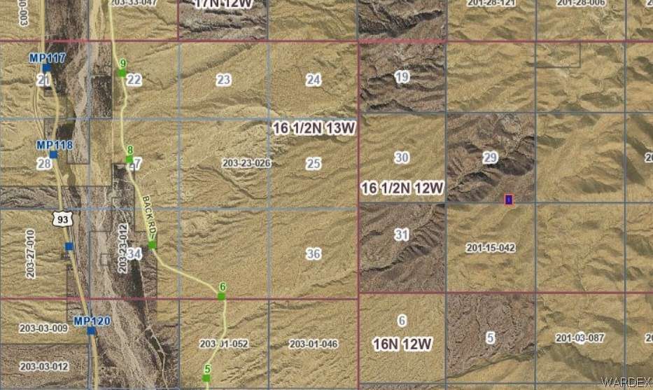
$600 dropEst $33/moThis land is full of nature, lots of trails to go on an adventure. Hiking, off road vehicles, camping under the stars, this has it all for any nature enthusiast. RV's are ok and if you choose to build, their is no timeframe. No HOA. There are no roads to this property but so many trails. Off Road Vehicle is recommended. Use GPS Coordinates Lat: 34.778697 N - Lon: 113.534518 W Seller is Owner Agent
Directions
Highway 93 S just south of Mile Marker 121, Exit East on Pump Station Road, Take Lower Trout Rd/Lower Trout Creek Rd which is also know as Back Rd just North of Mile Marker 6, take trail to the right (NE) to section. Walk to the final destination or off road vehicle.
Location
- Street Address
- Lower Trout Rd, Lot 104
- County
- Mohave County
- Elevation
- 3,304 feet
Property details
- Zoning
- RA Rural Area
- MLS Number
- WARDEX 013241
- Date Posted
Parcels
- 201-21-104
Legal description
T 16 1/2 N R12W SEC 29 STAR LIGHT HILLS BLK 4 LOT 104
Resources
Detailed attributes
Listing
- Type
- Land
- Subtype
- Agriculture
Listing history
| Date | Event | Price | Change | Source |
|---|---|---|---|---|
| Dec 29, 2024 | Price drop | $2,100 | $600 -22.2% | WARDEX |
| Aug 11, 2024 | Price drop | $2,700 | $250 -8.5% | WARDEX |
| May 7, 2024 | New listing | $2,950 | — | WARDEX |
Payment calculator
Contact listing agent
By submitting, you agree to the terms of use, privacy policy, and to receive communications.