Images
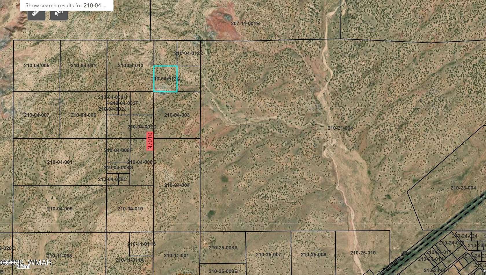
Map
Land for Sale in Holbrook, Arizona
Apache County, Holbrook, AZ 86025
$22,500
44.4 acres
Active
$2.5k drop
Est $206/moParcel - 210-04-012A-D
Location
- County
- Apache County
- School district
- St. Johns
- Elevation
- 5,892 feet
Directions
From Holbrook go Eat on US Hwy 40. Exit on next exit after Sun Valley. Turn left over the bridge. Turn Right onto 7006. Follow 7006 along Hwy 40. Follow 7006 North. Use the map Icon to identify exact location.
Property details
- Acreage
- 44.36 acres
- MLS #
- WMAR 242873
- Posted
Parcels
- 210-04-012A
Legal description
Section: 1 Township: 20N Range: 26E SW4 NE4 NE4 E 1219.94; E 1417.35; E 98.68; S 727.06; S 727.06; E 658.30; N 723.85; W 658.81; POB Section: 1 Township: 20N Range: 26E SE4 NE4 NE4; E 1219.94; E 1417.35; S 720.63; S 720.64; W 658.30; N 723.85; E 658.81; POB Section: 1 Township: 20N Range: 26E NE4 NE4 NE4 E 1219.95; E 1417.35; E 756.02; E 658.33; S 720.63; W 658.81; N 723.84; POB Section: 1 Township: 20N Range: 26E NW4 NE4 NE4 E 1219.94; E 1417.35; E 98.68; E 659.34; S 723.84; W 658.81; N 727.06; POB
Details and features
Listing
- Type
- Land
Lot
- Features
- Sloped
Exterior
- Features
- Level
Listing history
| Date | Event | Price | Change | Source |
|---|---|---|---|---|
| May 25, 2024 | Price drop | $22,500 | $2,500 -10% | WMAR |
| Sept 2, 2022 | New listing | $25,000 | — | WMAR |
Payment calculator
Contact listing agent
By submitting, I agree to the terms of use and to be contacted by real estate professionals. Message and data rates may apply.