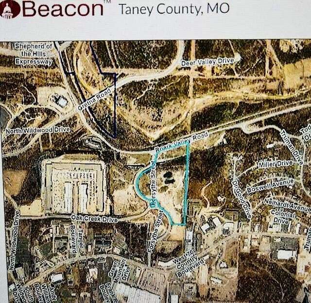
Land for Sale in Branson, Missouri
Forsythe St Branson, MO 65616
Images
Map
Street

$3,845,912
19.6 acres
Active
agoEst $27,601/mo19.62 acres of south side of Roark Valley Rd. and east of Forsythe St.A total of 37.87 acres avble @ $4.50/sf $7,421,315
Directions
From Hwy 76, north on Forsythe St., property of east side extending to Roark Valley Rd.
Location
- Street Address
- Forsythe St
- County
- Taney County
- Elevation
- 909 feet
Property details
- MLS Number
- GSBOR 60276146
- Date Posted
Property taxes
- 2023
- $427
Parcels
- 07-7.0-36-000-000-028.000
Legal description
SESE4 S OF ROARK VALLEY RD & E OF FORSYTHE ST; CIT
Detailed attributes
Listing
- Type
- Land
- Subtype
- Unimproved Land
Nearby schools
| Name | Level | District | Description |
|---|---|---|---|
| Branson Buchanan | Elementary | — | — |
| Branson | Middle | — | — |
| Branson | High | — | — |
Listing history
| Date | Event | Price | Change | Source |
|---|---|---|---|---|
| Aug 26, 2024 | New listing | $3,845,912 | — | GSBOR |
Payment calculator
Contact listing agent
By submitting, I agree to the terms of use, privacy policy, and to receive communications.