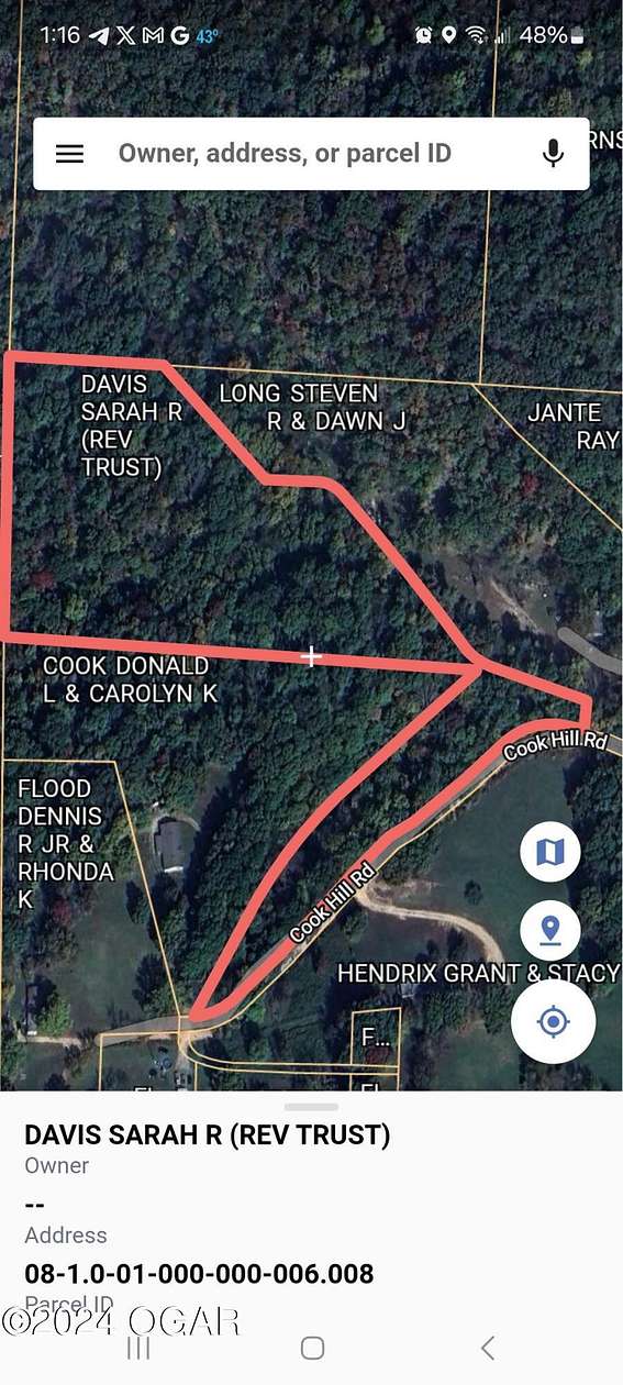
Residential Land for Sale in Anderson, Missouri
Cook Hill Rd Anderson, MO 64831
Image
Map

$28,500
7 acres
pending saleUnder contract
Wooded parcel of land tucked in the hills north of Anderson. NO Restrictions
Directions
Highway 59 to Maness rd, beside Arvest Bank, west to Park, left to Sellers, right across bridge and railroad tracks, then north to Cook Hill road, left to property on right
Property details
- County
- McDonald County
- Elevation
- 971 feet
- MLS Number
- OGAR 241374
- Date Posted
Parcels
- 08-1.0-01-000-000-006.008
Property taxes
- Year not provided
- $115
Listing history
| Date | Event | Price | Change | Source |
|---|---|---|---|---|
| July 9, 2024 | Under contract | $28,500 | — | OGAR |
| Apr 14, 2024 | Listing removed | $28,500 | — | — |
| Mar 28, 2024 | New listing | $28,500 | — | OGAR |
Payment calculator
Kevin VanStory
Swmohomes.com
Contact listing agent
By submitting, you agree to the terms of use, privacy policy, and to receive communications.