Improved Recreational Land & Farm for Sale in Burns, Oregon
Harney County Burns, OR 97720
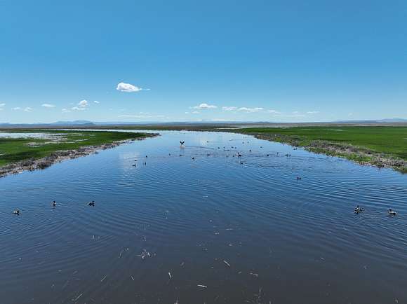
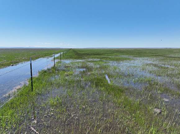

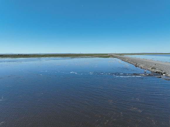
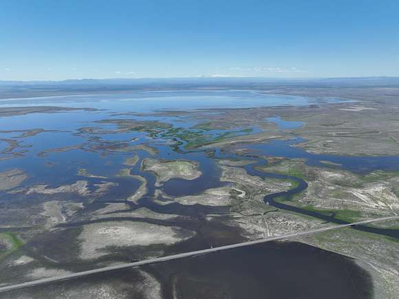


Silvies River Pasture
This Eastern Oregon property is located approx. 30 miles SE of Burns Oregon. The owner has been using this ranch to pasture 175 pairs from May to October on a normal water year plus has put up as much as 100 tons of meadow hay. The property has good stock water and approximately 1 1/2 miles of Silvies River running through the property. The owner also has adjoining pasture property listed separately and a hay farm for more running capacity and hay base. This property is a good summer pasture for your cattle operation.
Malheur Lake in Oregon has been a significant location for Native American activity throughout history. The lake's abundant natural resources and favorable climate attracted tribes such as the Paiute and Bannock, who relied on its fish, waterfowl, and edible plants for sustenance. The Native American presence at Malheur Lake spanned centuries, and they practiced traditional hunting, fishing, and gathering methods, maintaining a sustainable relationship with the environment.
Beyond its practical value, Malheur Lake held immense cultural significance for Native American tribes. It served as a gathering place for social, cultural, and spiritual activities, fostering intertribal connections and preserving indigenous traditions. Ceremonies, storytelling, and trade took place on its shores, and the lake's tranquil waters and picturesque landscapes inspired artistic expressions, songs, and dances that celebrated the region's natural beauty and abundance.
Overall, Malheur Lake stands as a reminder of the historical and cultural importance of Native American activity in the region. Preserving and acknowledging this legacy is crucial for honoring the rich tapestry of Native American history and identity in Oregon.
LOCATION:
T25S R32 1/2 E WM Tax Lot 6700
T25S R32E WM Tax Lot 800
ACREAGE:
918.51 total deeded acres consisting of the following:
- 720.2 +/- acre flood irrigated
- 197.31 +/- acre native pasture
- 1 +/- acres set of corrals
UTILITIES:
Power Company - Harney Electric Coop
Phone Company - Cell Phones
WATER RIGHTS:
Priority Date # Acres Source
Dec 31, 1888 164.6 Silvies River
Dec 31, 1891 515.6 Silvies River
Dec 31, 1914 40 Silvies River
Dec 31, 1900 51.15 Silvies River
Dec 31, 1896 70.91 Silvies River
Total = 842.26
WELLS: 3 - Stock wells
IMPROVEMENTS: 1 - set of working corrals
TAXES: 2023/2024 - $506.92 (farm deferral)
Location
- County
- Harney County
- Elevation
- 4,101 feet
Property details
- Date Posted
Listing history
| Date | Event | Price | Change | Source |
|---|---|---|---|---|
| Jan 3, 2025 | Relisted | $1,650,000 | — | Listing agent |
| Jan 1, 2025 | Listing removed | $1,650,000 | — | Listing agent |
| Oct 29, 2024 | Price drop | $1,650,000 | $850,000 -34% | Listing agent |
| June 26, 2024 | New listing | $2,500,000 | — | Listing agent |