Skip to main content
Skip to navigation
Properties
Find agent
Post listing
Log in
•
Sign up
Search here
List
Mount Airy, NC land for sale
Price
Size
Tags
Save
167 properties
Updated
For you
Newest
Price: high to low
Price: low to high
Size: large to small
Size: small to large
Updated
22 hours
$68,200
3.1 acres
Carroll County
Cana, VA 24317
2 days
$229,900
2.6 acres
Surry County
3 bd, 2 ba
•
1,292 sq ft
Mount Airy, NC 27030
5 months ago
$45,000
3.29 acres
Surry County
Pilot Mountain, NC 27041
5 months ago
$40,000
1.5 acres
Surry County
Pilot Mountain, NC 27041
Pending
Under contract
$1,179,000
16.5 acres
Surry County
3 bd, 6 ba
•
4,481 sq ft
Mount Airy, NC 27030
Pending
Under contract
$175,000
2.6 acres
Surry County
3 bd, 2 ba
•
1,400 sq ft
Mount Airy, NC 27030
3 months ago
$249,900
1.9 acres
Surry County
4 bd, 2 ba
•
1,945 sq ft
Dobson, NC 27017
$20k drop • Feb 20
$30,000
1.4 acres
Surry County
Pinnacle, NC 27043
3 days
$219,900
1.6 acres
Surry County
2 bd, 2 ba
•
1,276 sq ft
Mount Airy, NC 27030
20 days
$699,900
5.7 acres
Surry County
— sq ft
Mount Airy, NC 27030
5 years ago
$275,000
18.9 acres
Surry County
Pilot Mountain, NC 27041
Pending
Under contract
$400,000
20.2 acres
Surry County
Mount Airy, NC 27030
3 years ago
$16,500
1.67 acres
Surry County
Mount Airy, NC 27030
5 days
$9,500
0.6 acres
Carroll County
Fancy Gap, VA 24328
$34k drop • Feb 18
$515,900
2.53 acres
Surry County
4 bd, 3 ba
•
3,023 sq ft
Mount Airy, NC 27030
Pending
Under contract
$485,000
1.74 acres
Surry County
3 bd, 4 ba
•
2,139 sq ft
Mount Airy, NC 27030
5 days
$16,500
0.5 acres
Carroll County
Fancy Gap, VA 24328
5 days
$9,500
0.8 acres
Carroll County
Fancy Gap, VA 24328
$25.5k drop • Feb 17
$599,500
17 acres
Surry County
4 bd, 3 ba
•
2,650 sq ft
Dobson, NC 27017
6 days
$479,900
2 acres
Carroll County
2 bd, 2 ba
•
2,160 sq ft
Fancy Gap, VA 24328
$30k drop • Feb 16
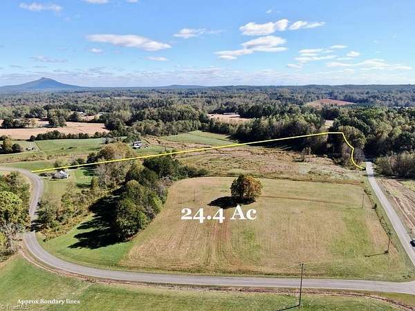
$295,000
24.4 acres
Surry County
Ararat, NC 28625
Pending
Under contract
$419,900
38.4 acres
Surry County
Mount Airy, NC 27030
Pending
Under contract
$50,000
2.46 acres
Surry County
Pilot Mountain, NC 27041
Pending
Under contract
$549,900
9.4 acres
Surry County
3 bd, 4 ba
•
2,782 sq ft
Pilot Mountain, NC 27041
22 months ago
$25,900
2.88 acres
Surry County
Mount Airy, NC 27030
5 months ago
$25,000
2.37 acres
Surry County
Mount Airy, NC 27030
8 months ago
$369,900
4.26 acres
Surry County
3 bd, 2 ba
•
1,785 sq ft
Mount Airy, NC 27030
Pending
Under contract
$29,900
5 acres
Surry County
Mount Airy, NC 27030
Pending
Under contract
$70,000
1.86 acres
Surry County
Pilot Mountain, NC 27041
13 days
$175,500
9.75 acres
Surry County
Dobson Township, NC 27017
13 days
$194,400
10.8 acres
Surry County
Dobson Township, NC 27017
$5k drop • Jan 9
$112,000
15 acres
Surry County
Mount Airy, NC 27030
16 days
$149,900
1.15 acres
Surry County
Dobson, NC 27017
30 days ago
$235,000
2.54 acres
Carroll County
3 bd, 2 ba
•
2,388 sq ft
Cana, VA 24317
37 days ago
$1,047,397
4 acres
Surry County
Mount Airy, NC 27030
Pending
Under contract
$49,000
0.9 acres
Surry County
Dobson, NC 27017
39 days ago
$120,000
11.8 acres
Surry County
Mount Airy, NC 27030
Pending
Under contract
$65,000
6.16 acres
Surry County
Pilot Mountain, NC 27041
Pending
Under contract
$59,500
5 acres
Surry County
Ararat, NC 27007
Pending
Under contract
$39,400
7.8 acres
Surry County
Mount Airy, NC 27030
Pending
Under contract
$25,000
2.1 acres
Surry County
Pilot Mountain, NC 27041
Pending
Under contract
$249,000
2.74 acres
Surry County
2 bd, 1 ba
•
1,461 sq ft
Pilot Mountain, NC 27041
15 months ago
$273,600
22.2 acres
Surry County
Mount Airy, NC 27030
37 days ago
$2,674,371
10.3 acres
Surry County
Mount Airy, NC 27030
$30k drop • Jan 29
$220,000
23.6 acres
Surry County
Mount Airy, NC 27030
25 days
$150,000
0.46 acres
Surry County
Dobson, NC 27017
7 months ago
$74,500
6 acres
Patrick County
Ararat, VA 24053
7 months ago
$9,900
0.33 acres
Patrick County
Hillsville, VA 24343
16 months ago
$45,000
2.23 acres
Carroll County
Fancy Gap, VA 24328
2 years ago
$65,000
2.83 acres
Carroll County
Fancy Gap, VA 24328
1
2
3
4
1-50 of 167 properties
Map