Land for Sale in Lancaster, California
Aka E Avenue H 4 Lancaster, CA 93535
Image
Map

$16,000
1.29 acres
Active sale agoEst $125/mo
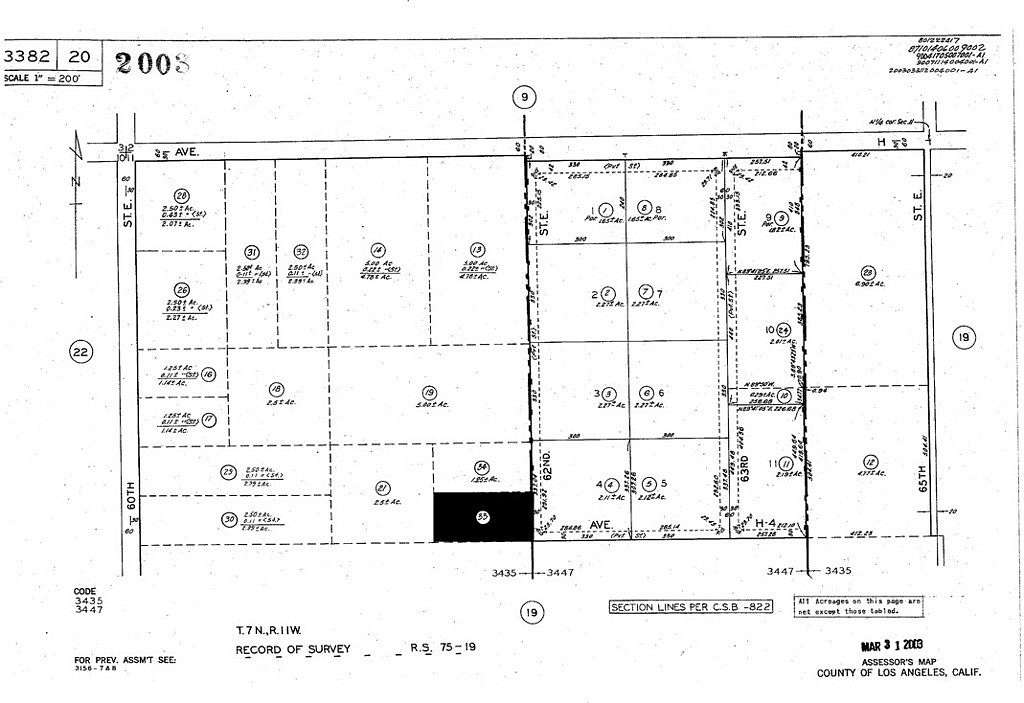
Start the Ranch in northern Los Angeles County. Room for good size home and large yard. This 1.29-acre land has panoramic views on the east side of Antelope Valley, close to the heart of Roosevelt. There is a church, and several houses already built in the immediate area. About ten miles away is Antelope Center, Palmdale and Lancaster. The lot is on a dirt road, but accessible from paved roads to get there. Parcel number is 3382-020-033. Latitude and longitude coordinates are: 34.715731,-118.019415. Standard sale.
Directions
south of paved E Ave H between paved 60th st and dirt 65th. Its west on E Ave H4 then north side
Location
- Street Address
- Aka E Avenue H 4
- County
- Los Angeles County
- Elevation
- 2,388 feet
Property details
- Zoning
- LCA21*
- MLS Number
- MRMLS CV24178413
- Date Posted
Parcels
- 3382020033
Detailed attributes
Listing
- Type
- Land
- Franchise
- Century 21 Real Estate
Lot
- Views
- Desert, Hills, Panorama
Exterior
- Features
- Rural Community Features Included
Listing history
| Date | Event | Price | Change | Source |
|---|---|---|---|---|
| Aug 27, 2024 | New listing | $16,000 | — | MRMLS |
Payment calculator
Contact listing agent
By submitting, you agree to the terms of use, privacy policy, and to receive communications.