Recreational Land for Sale in Monroe, Michigan
7800 E Dunbar Rd, Monroe, MI 48161
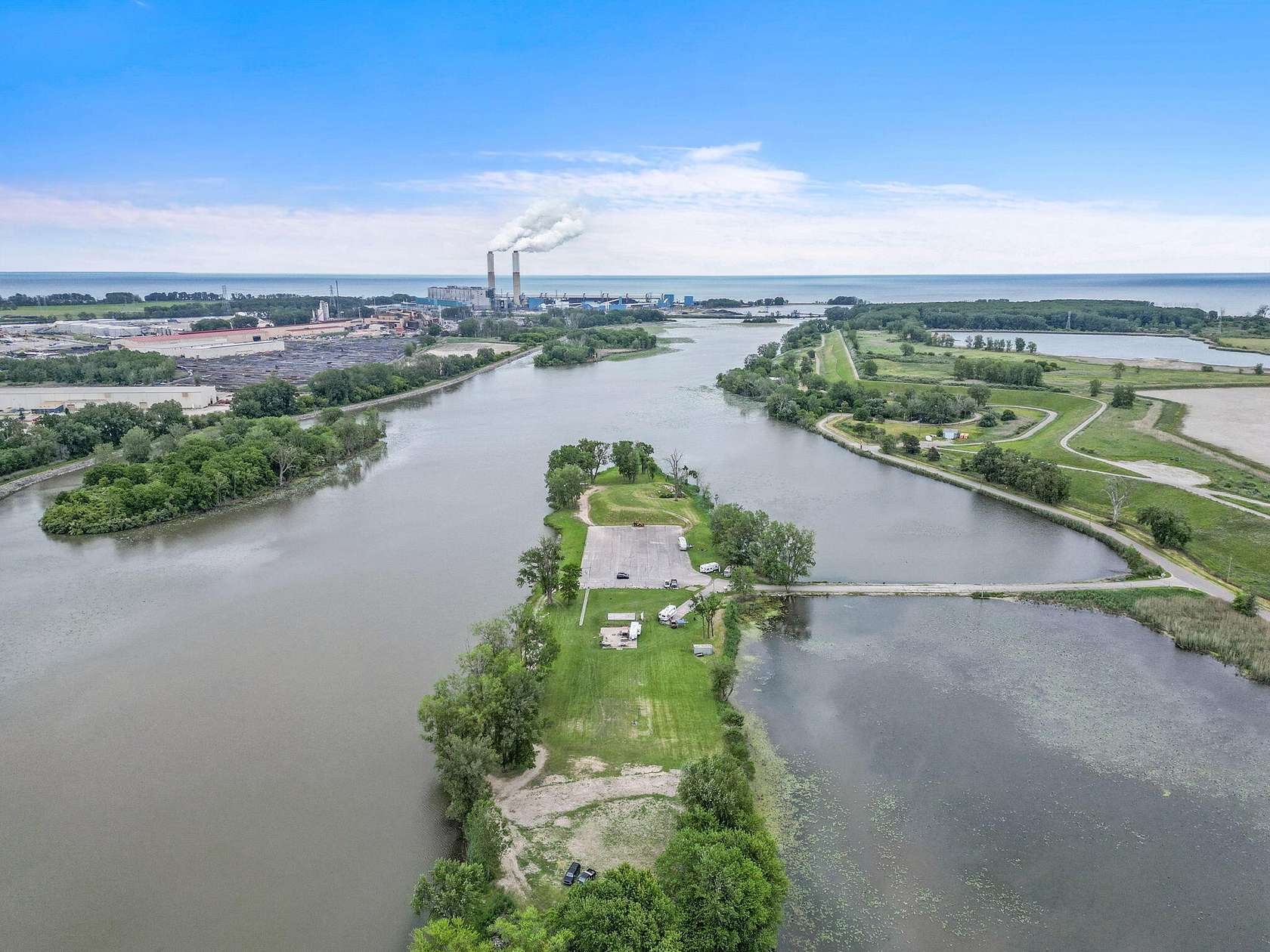
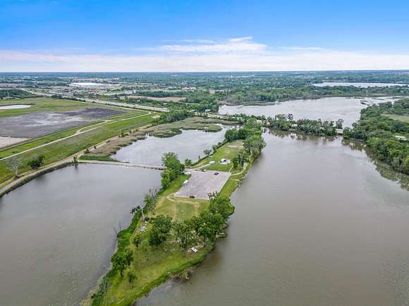
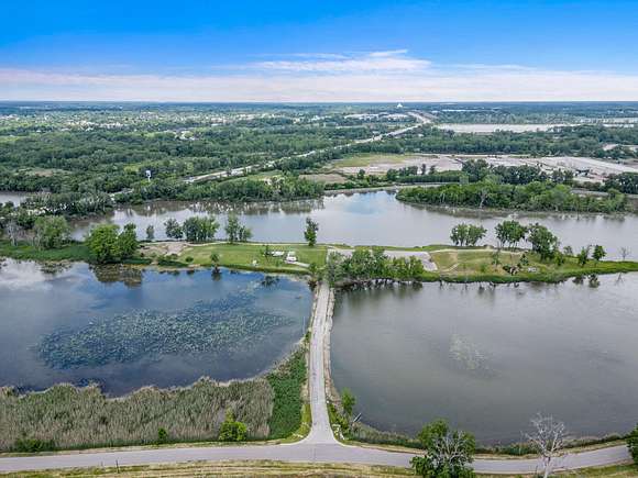
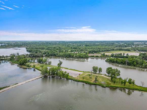
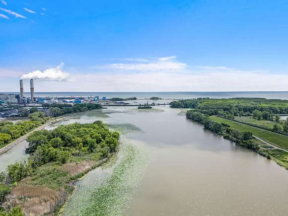
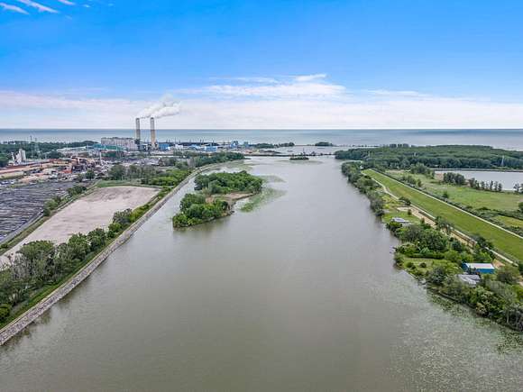
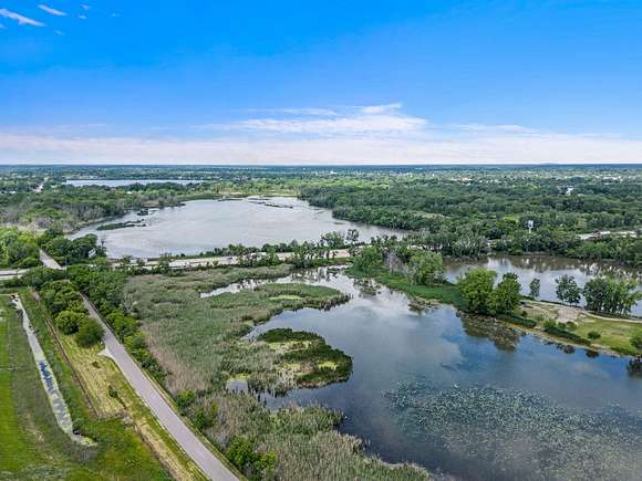
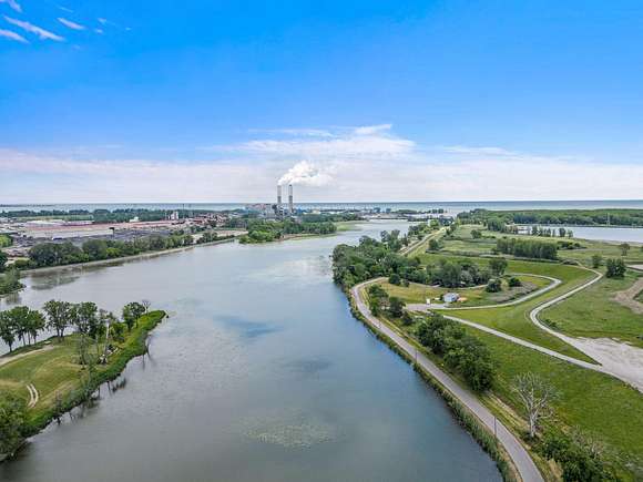
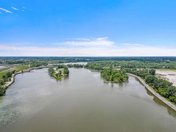
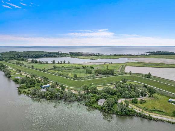
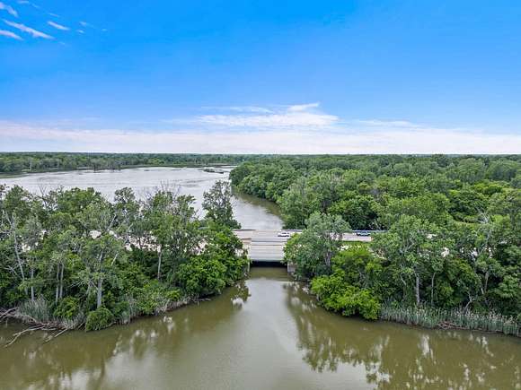
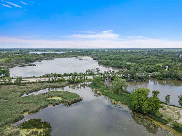

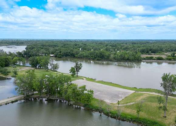
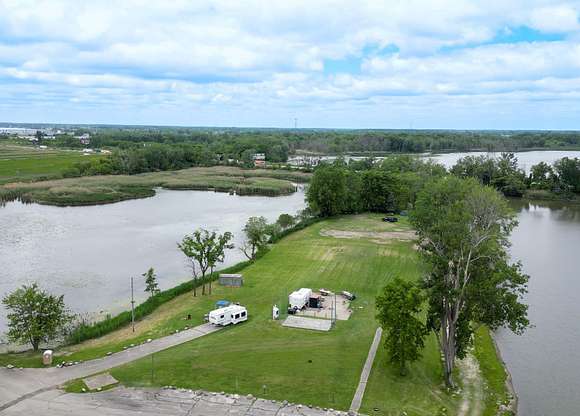
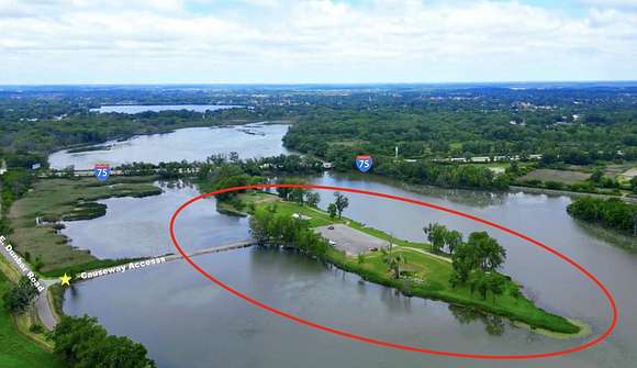
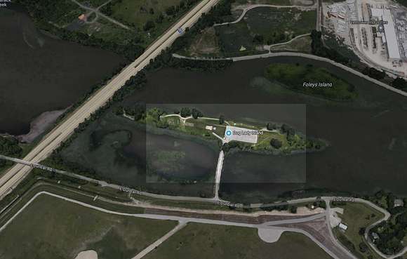
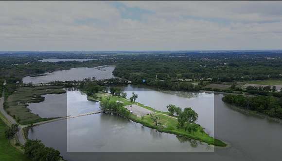
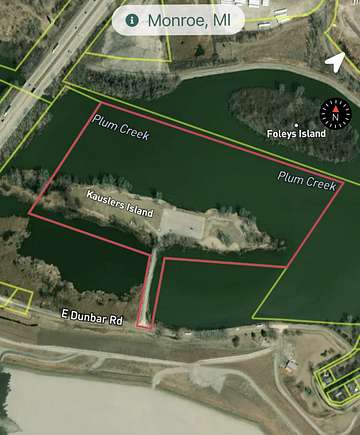
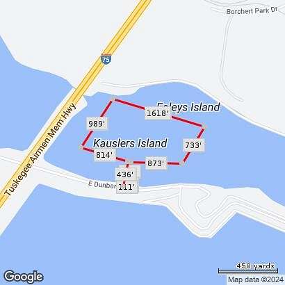

PLUM CREEK PRIVATE ISLAND FLOWS DIRECTLY TO LAKE ERIE
Property Details:
Location: 7800 E. Dunbar Rd., Monroe, MI
Total Acreage: 33 acres (12 acres of land, 21 acres of water rights)
Zoning: AG / Special Use Commercial NIC (formerly AG)
Utilities: Electricity on site. Water Available (Public), Septic Available.
Current Use: Primitive camping site and RV parking (Dog Lady Island)
Waterfront Access: Deepwater trenches around the island. Boat & jet ski launch, fishing, and direct access to Lake Erie
Wildlife: Adjacent to state-protected wildlife and wetlands, home to rare wildlife, birds, fish, and amphibians
Concrete Pad: 1.5 acres
Flood zone: 100-Year Flood Zone (1% annual chance of flooding)
Water Quality: Plum Creek is note PLUM CREEK PRIVATE ISLAND FLOWS DIRECTLY TO LAKE ERIE
Property Details:
Location: 7800 E. Dunbar Rd., Monroe, MI
Total Acreage: 33 acres (12 acres of land, 21 acres of water rights)
Zoning: AG / Special Use Commercial NIC (formerly AG)
Utilities: Electricity on site. Water Available (Public), Septic Available.
Current Use: Primitive camping site and RV parking (Dog Lady Island)
Waterfront Access: Deepwater trenches around the island. Boat & jet ski launch, fishing, and direct access to Lake Erie
Wildlife: Adjacent to state-protected wildlife and wetlands, home to rare wildlife, birds, fish, and amphibians
Concrete Pad: 1.5 acres
Flood zone: 100-Year Flood Zone (1% annual chance of flooding)
Water Quality: Plum Creek is noted for its cleanliness and purity
Potential Uses:
Event Space
(Before the RV Park/Campground, the island hosted concerts and community events)
Marina/outdoor sports lake boat launch, fishing
Storage/Parking
Recreational Area
Parking/Storage
Farming/Greenhouse
Residential Development
Contact Monroe Charter Township; Planning & Zoning Department regarding potential Special Land Use Permits and Zoning Variances.
Monroe Charter Township
4925 East Dunbar Road
Monroe, MI 48161
(734) 241-55011
Kim Fortner
Community Development Director & Zoning Enforcement Officer
(734) 241-5502 | kfortner@monroechartertownship.org
Directions
From S. Laplaisance, turn left on to E. Dunbar Road, then turn left on to the causeway.
Location
- Street Address
- 7800 E Dunbar Rd
- County
- Monroe County
- School District
- Monroe
- Elevation
- 577 feet
Property details
- MLS #
- GRAR 24030906
- Posted
Property taxes
- 2023
- $421
Parcels
- 12-020-292-00
Legal description
MAP 24 PC 561-562 33 AMOL 8 AMOL ABOVE WATER COM 1741.21 FT N 70 56' W FR THE SE COR OF PC 349 TH N 70 56' W 1722.71 FT ALG THE S LI OF PC 349 TH S 35 51'W 893.31 FT TH S 70 19'40'' E 866.53 FT TH S 11 31' W 484.15 FT TH S 83 34'' E 18.71 FT TH S 76 31 ' E 81.41 FT TH N 11 31' E 483.50 FT TH S 84 41'40'' E 827.86 FT TH N 34 38'45'' E 685.94 FT TO POB
Resources
Detailed attributes
Listing
- Type
- Land
- Franchise
- Real Estate One
Lot
- Features
- Lake, River, Stream/Creek, Waterfront
Exterior
- Features
- Buildable, Recreational, Wetland Area
Listing history
| Date | Event | Price | Change | Source |
|---|---|---|---|---|
| June 18, 2024 | New listing | $1,600,000 | — | GRAR |