Land for Sale in Westcliffe, Colorado
6201 & 6245 Hwy 96 Westcliffe, CO 81252
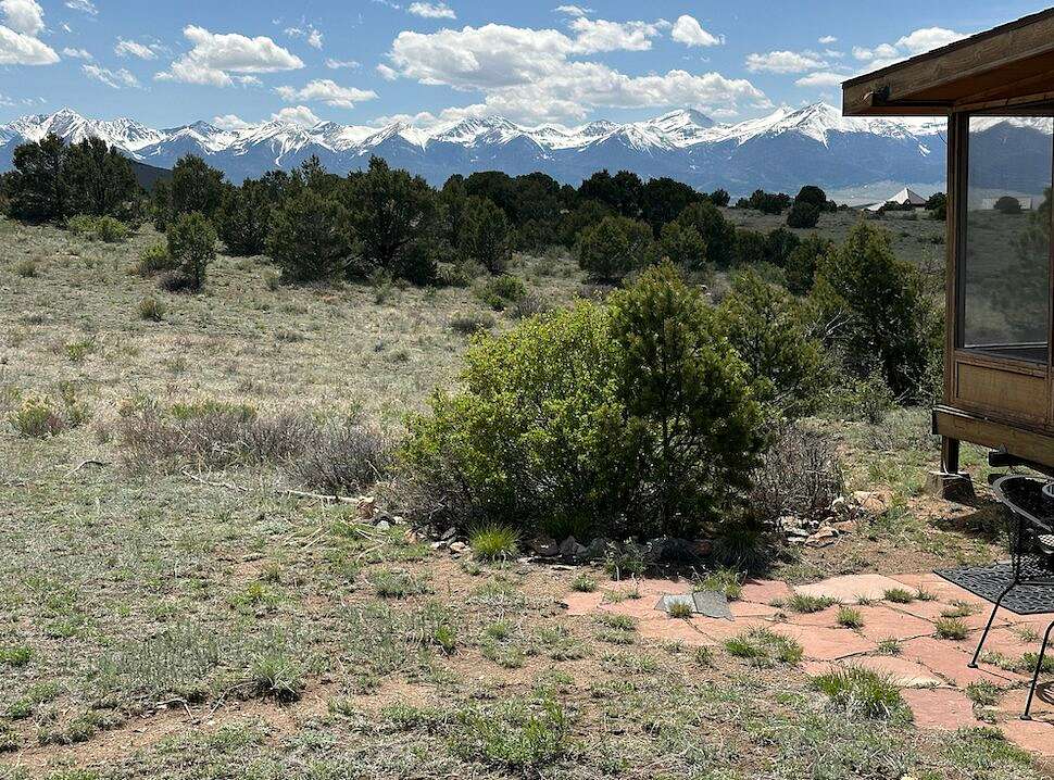


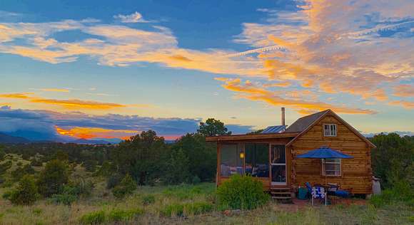

Experience mountain life at its best at Close In but Far Away - 121.43 acres of undeveloped residential land in Custer County, Colorado. The property has an 81.42-acre north parcel with an off-the-grid cabin and a 40.01-acre south parcel. Enjoy unspoiled views of the Sangre de Cristo mountains, only 6 miles from Westcliffe and 1.5 hours from Colorado Springs. NO HOA!
Land
Do you dream of building a mountain home or vacation getaway on a large, quiet and very private parcel, with sunny skies 300 days a year and amazing views, surrounded by hundreds of acres of unspoiled land that also offers nearby access to thousands of additional acres of wilderness for hiking, camping, boating, hunting, and summer and snow sports?
This is an exceedingly rare opportunity to purchase a large, yet close-in tract just down the road from the quaint old-West mining town of Westcliffe, Colorado, 1.5 hours from Colorado Springs and its airport, and 2.5 hours from Denver and Denver International Airport.
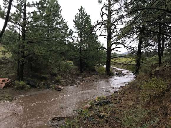
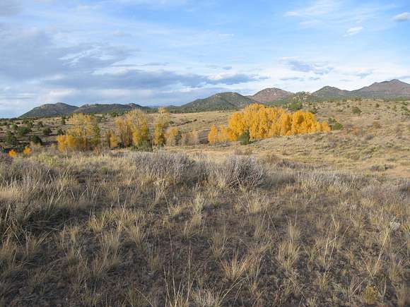
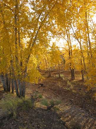
Designated for residential, ranching, and farming use, this parcel offers million-dollar Colorado views of the Sangre de Cristo Mountains to the south and west, the Arkansas River Valley and the Collegiate Mountains to the north, and the Wet Mountains to the east. Bounding with wildlife, the terrain is one of wildflowers, rock outcroppings, waving grass meadows, and Ponderosa pine, juniper, and pinon, dotted by groves of narrow-leaf cottonwoods. Two deep, wide gulches traverse the property, including the historic Carolina Gulch across the southwest corner of the south parcel and another unnamed gulch that follows just south of the northern boundary. Each gulch is fed by underground springs and can run with water during rainy seasons.
The land is easily accessible from Colorado Hwy 96 via a 2-mile, well-maintained dirt/gravel road. Yet this is unparalleled privacy, thanks to 640 acres of State Trust land bordering the property to the north, more than 1,000 acres of conservation easement-protected private land to the east, and a tract of several thousand acres to the west.
Electricity crosses both parcels on recently upgraded power lines and is available on the north parcel via two existing drops approximately 500 feet from likely building sites. One residential well allowance accompanies each building envelope.
North 81-acre Parcel and Building Envelope
The main north parcel features an extended hillside stand of pine, junipers, and pinon, the back gulch, and a 4-acre building envelope with a small, off-the-grid cabin (needs septic), boasting breathtaking views of the Sangre de Cristo Mountains and their technicolor sunsets and sunrises.
If requested, the sale includes plans for a 2,000 sq. ft., three-bedroom, open-floor plan home with outdoor living spaces and an attached garage, designed by Westcliffe Builders, one of the valley's premiere custom home builders.
South 40-acre Parcel and Building Envelope
The legally defined south parcel, with a 3-acre building envelope, enjoys the same level of privacy and spectacular views of the larger north parcel. There is easy access from the eastern road, and electricity is available from the power line immediately east of the building envelope. This parcel offers future development possibilities that include the construction and sale of a possible spec home, a close-by residence for friends and family, or the option to simply maintain the property as is.
Conservation Easement
The entire property was placed under a conservation easement in December 2007 with San Isabel Land Protection Trust, now Colorado Open Lands. The easement permanently protects the property from additional development and increased density. The easement outlines the rights of the land trust and property owner and permitted uses, including full conveyances, the right to construct up to two single-family dwellings, and other new, non-residential structures and fences, and the ability to conduct ranching and farming operations, among other rights.
Improvements
The 252-sq.-ft. insulated, furnished cabin with matching screened-in porch offers surprising amenities: numerous windows, propane stove/oven, a sleeping loft, a Jotul wood stove, and DC/AC power (a recently upgraded 200-watt solar system and battery provide lighting, music, and computer, phone, and small appliance recharging). The cabin could be expanded and amended with electricity, septic and water hookups. Phone hotspots provide internet; satellite-based internet is available locally. There is also a detached 8'x8' Tuff Shed with a workbench and room for storage.
Recreation
Colorado State Trust property
Immediately adjacent to the property's north boundary is a 640-acre tract, part of a system of public land held in a trust and used for public beneficiaries, in this case, support of Colorado public schools. The State Trust program dates to the Northwest Ordinance of 1785. With this ordinance, the U.S. Congress established a policy of granting land to states when they entered the Union as an asset to generate funding to support the public education system. Colorado received two sections per township, totaling four million acres at statehood in 1876. The State Trust in Colorado presently includes 2.8 million acres.
Region & Climate
Climate in Westcliffe/Silver Cliff, Colorado
Climate in Westcliffe/Silver Cliff, Colorado
Westcliffe/Silver Cliff, Colorado gets 14 inches of rain, on average, per year. The US average is 38 inches of rain per year.
Westcliffe/Silver Cliff averages 86 inches of snow per year. The US average is 28 inches of snow per year.
On average, there are 260 sunny days per year in Westcliffe/Silver Cliff. The US average is 205 sunny days.
Westcliffe/Silver Cliff gets some kind of precipitation, on average, 83 days per year. Precipitation is rain, snow, sleet, or hail that falls to the ground. For precipitation to be counted, you must get at least .01 inches on the ground to measure.
Weather Highlights
Summer High: The July high is around 81 degrees
Winter Low: The January low is 8
Rain: averages 14 inches of rain a year
Snow: averages 70 inches of snow a year
History
This property was once part of a 2,400-acre ranch owned by a Denver dentist, George B. Stanley, known locally as Doc Stanley, and his family. After his death in 1985, the family later sold off approximately 1,200 acres of the western portion of the ranch, part of which became Cottonwood Springs Ranch. As part of the Cottonwood Springs Ranch (CSR) subdivision, created in 1995, consisting of 8 approximately 40-acre parcels, the 121-acre parcel for sale was originally represented as parcels 6, 7, and 8, which formed the northernmost pieces of CSR. The current owners are the first owners of these parcels since the creation of the subdivision. There are no HOA or HOA dues; covenants filed with the original CSR plats are in effect but have not been in play or enforced for many years.
Location
This is wild, unspoiled Colorado, home to mule deer, pronghorn antelope, mountain lion, bobcat, elk, bear, jackrabbits, hawks, and eagles. The adjoining towns of Westcliffe, founded in 1881, population 435, and Silver Cliff, first settled in 1869, population 706, sit in the middle of the Wet Mountain Valley at just over 7,000 feet altitude. Both are Western laid back and friendly. The region has a rich mining and ranching heritage, and Westcliffe supports a thriving arts, theater, and retail community. Westcliffe serves as the county seat for Custer County, which listed a total population of 5,045 in 2021. In 2010, the county was ranked as the tenth least populated in Colorado.
The property lies on the western shoulder of the Wet Mountains with the sprawling Wet Mountain Valley and the towering Sangre de Cristo range to the west. With its 10 majestic "fourteeners, the Sangre de Cristos (Spanish for "Blood of Christ") earned their name from the brilliant colors of the sunsets and sunrises and the lavender, red and pink hues of the peaks. The range offers 220,803 acres of wilderness in the San Isabel National Forest for hiking, camping, and fishing.
Nearby amenities include the historic old mining towns of Westcliffe and Silver Cliff; DeWeese Reservoir (camping, fishing); Pueblo, just over an hour by car; Canon City (1 hour); Salida (1 hour) and the Arkansas River; Royal Gorge (1.5 hours); Mission Wolf Refuge; Monarch Ski Area (1 hour 20 minutes); Pueblo State Park (1 hour); Bishops Castle (Rye, Colo.); Great Sand Dunes National Park; Taos, NM (2:45); and Santa Fe, NM (4:15).
Location
- Street Address
- 6201 & 6245 Hwy 96
- County
- Custer County
- Elevation
- 8,150 feet
Property details
- Date Posted
Listing history
| Date | Event | Price | Change | Source |
|---|---|---|---|---|
| July 30, 2024 | Price drop | $679,000 | $20,000 -2.9% | — |
| Jan 20, 2024 | Price drop | $699,000 | $26,000 -3.6% | — |
| Sept 14, 2023 | New listing | $725,000 | — | — |
