Land for Sale in Sunbright, Tennessee
442 Ridge Top Cir Sunbright, TN 37872
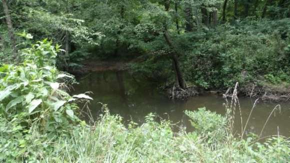
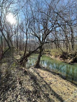

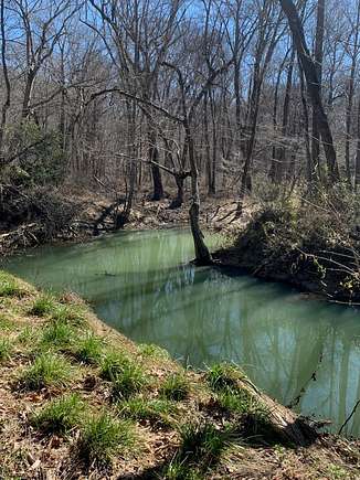
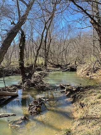


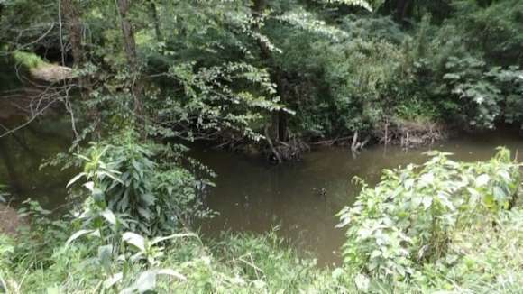


30.91 surveyed ac located in a remote & secluded county mountain rural location. In the mountains of TN. Public water is installed, electric & telephone available, percolation test on fille for a 3BD system. Black Wolf Creek runs through the property - year around. Stream & spring. Modest restrictions to protect the value of your property. Mature timber - mostly hardwood. Loads of wildlife (deer, turkey, wild hog, elk, coon, rabbits and more). Over 1500+ ft of rd frontage. Easy access off Ridge Top Road with an improved driveway to an awesome building site with mtn views. Natural Gas Well on the property - lease has expired - will transfer to the buyer at closing. NOTE: Need side by side or a 4-wheeler or walk going into the property to view. Buyer to do own due diligence & pertinent information. Lots 27 & 28.
Directions
TO 442 RIDGE TOP CIRCLE SIDE ACESS: From Onieda, TN: Continue to Route 27 to Sunbright. Go through Sunbright until Glenmary. T. R. on Coal Hill Rd / Campground Rd. Cont 1.5 miles T. R. on Henry Rd / Wolf Creek Rd. Cont 7/10's of a mile T. L. on Henry Rd and 2/10's of a mile a left on Ridge Top Circle cont 2/10's of a mile to the property on the Right with purple & yellow R. E. signs. Use 430 Ridge Top Circle; Sunbright, TN on your GPS to get to the property (the adjoining neighbor). TO THE WOLF CREEK ROADSIDE: From I-75 take Exit 141 to Huntsville/Oneida. Cont approx. 20 miles T. L. onto Hwy 27 S. Cont mile turn L. on Wolf Creek Road. Cont approx 5 miles property on the Right with purple & yellow R. E. signs. NOTE: Need side by side or a 4-wheeler or walk going into the property to view.
Location
- Street Address
- 442 Ridge Top Cir
- County
- Scott County
- Community
- Scott
- Elevation
- 1,493 feet
Property details
- Zoning
- Farm/Res
- MLS Number
- UCAR 228144
- Date Posted
Parcels
- 011.12
- 011.13
Resources
Detailed attributes
Listing
- Type
- Land
- Subtype
- Farm
Exterior
- Features
- Livestock Permitted
Listing history
| Date | Event | Price | Change | Source |
|---|---|---|---|---|
| June 21, 2024 | New listing | $225,000 | — | UCAR |