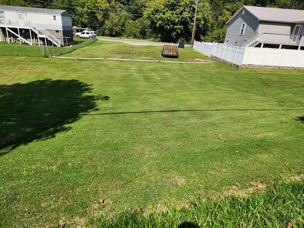
Residential Land for Sale in Freeburn, Kentucky
43774 ST Highway 194 E, Freeburn, KY 41528
Approx. .33 of an acre flat and ready for building or a mobile home. Public utilities available. Property not in the flood zone per seller. It is the buyer's responsibility to confirm if the property is in flood zone. Buyer responsible for a survey if exact property lines are in question. Call today for your showing. Property Map #196-10-04-004.00 MLS 123797
Location
- Street address
- 43774 ST Highway 194 E
- County
- Pike County
- Elevation
- 712 feet
Directions
Turn right onto Old Hwy 119/Toler Rd for approx. .4 miles. Turn right onto State Hwy 319 for approx. 6.5 miles. Turn left onto State Hwy 1056 for approx. 1.5 miles. Turn right onto Peter Fork Rd for approx. 2.8 miles. Continue onto Pounding Mill Rd for approx. .9 miles. Turn left onto KY-194 E for approx. .1 miles. Turn right to stay on KY-194 E for approx. .2 miles. Property is on the left.
Property details
- Lot size
- 0.33 acres14,375 sq ft
- Zoning
- Residential
- MLS #
- EKTAR 123797
- Posted
Resources
Nearby schools
| Name | Type |
|---|---|
| Phelps | High |
Listing history
| Date | Event | Price | Change | Source |
|---|---|---|---|---|
| Sept 6, 2025 | Price drop | $20,000 | $2,500 -11.1% | EKTAR |
| Mar 21, 2025 | Price drop | $22,500 | $2,500 -10% | EKTAR |
| Sept 14, 2024 | New listing | $25,000 | — | EKTAR |