
Land for Sale in Pace, Florida
41 Buffalo Creek Dr, Pace, FL 32571
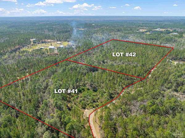
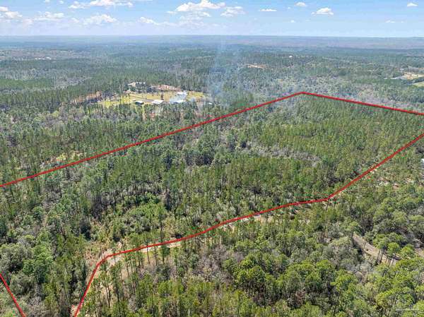
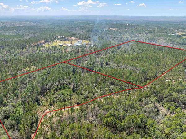
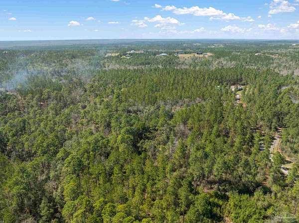
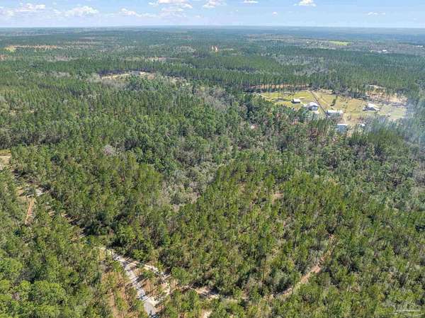
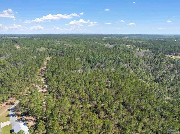
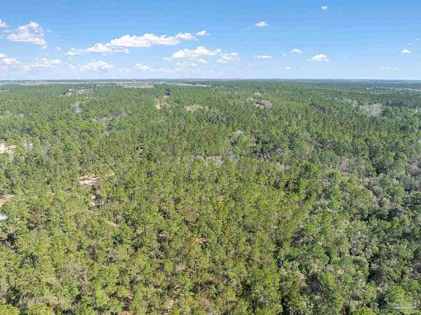
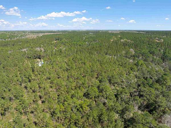
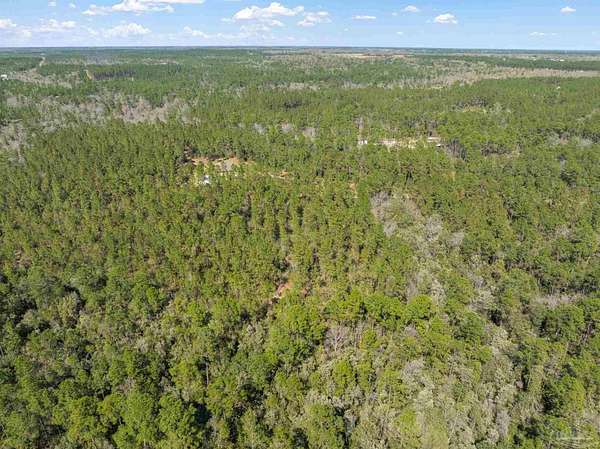
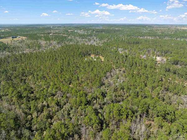
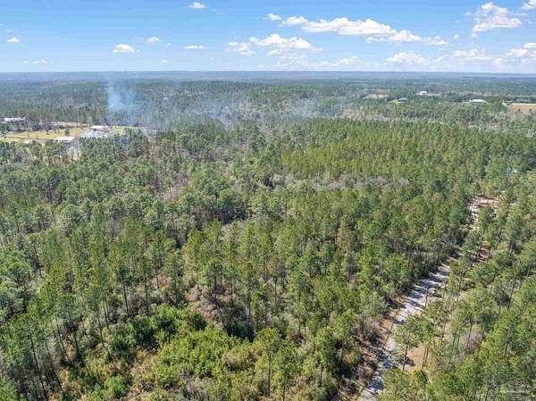
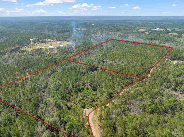
Bring your plans, and Build your DREAM HOME on this 16.384 acre property located in the beautiful Buffalo Creek Estates in Pace. This is Lot 41 (Parcel #02-2N-30-0000-00138-0000). This parcel is accessed by the Buffalo Creek Drive Private Road, and provides ample privacy. This property has a private road maintenance agreement for Buffalo Creek Drive which is $250/year - and this provides maintenance of Buffalo Creek Drive. Parcel is currently timber, and utilities will need to be added. Please note that and the joining Lot 42 (an additional 15.404 acres and Parcel #03-2N-30-0000-00105-0000 ) is also available available for purchase. Please refer to MLS # 661559. This acreage is ready for your next home!
Location
- Street address
- 41 Buffalo Creek Dr
- County
- Santa Rosa County
- Community
- Buffalo Creek Estates
- Elevation
- 141 feet
Directions
Quintette Road to Ten Mile to Buffalo Creek Dr (Private Drive) Keep Left on Yellowstone Drive and go until see clearing that separates Lot 40 and Lot 41
Property details
- Acreage
- 16.384 acres
- MLS #
- PAR 661558
- Posted
Parcels
- 022N300000001380000
Legal description
*DESCRIPTION UPDATE FOR 2021* *NEW PARCEL FOR 2017* UNREC SUB BUFFALO CREEK LOT 41: COM AT NE OF SEC 2-2N-30W THN S2*36'15"W ON E SEC LN 2653.83 FT TO S LN OF N2 OF SEC THN N87*17'07"W ON S LN 4582.83 FT FT THN S0*56'18"E 1302.01 FT TO C/L OF 40' INGRESS/EGRESS/ UTILITY ESMNT AKA BUFFALO CREEK DR FOR POB THN S34*05'35 "W 671.98 FT THN S55*54'25"E 958.80 FT N39*28'12"E 970.18 FT TO C/L OF BUFFALO CREEK RD THN N75*13'02"W 158.28 FT THN S88*17'32"W ON C/L 169.22 FT THN S69*37'35"W 280.76 FT THN N37*40'48"W 156.85 FT THN N57* 55'38"W 162.50 FT THN N40*53' 53"W 143.58 FT THN N49*20'28"W 56.16 FT THN N56*33'27"W 94. 07 FT TO POB TOGETHER WITH & SUBJ TO A 40 FT INGRESS/EGRESS /UTILITY EASEMENT & ALSO PORT OF UNREC SUB BUFFALO CREEK LOT 42 LYING WITHIN SEC 02-2N-30W: COM AT NE OF SEC 2-2N-30W THN S2*36'15"W ON E SEC LN 2653.83 FT TO S LN OF N2 OF SEC THN N87*17'07"W ON S LN 4582.83 FT THN S00*56'18"E 1302.01 FT TO C/L OF 40' INGRESS/EGRESS/ UTILITY ESMNT AKA BUFFALO CREEK DR FOR POB THN S34*05'35 "W 671.98 FT THN N55*54'25"W 837.76 FT TO PT "A" & CONT 137 .10 FT TO C/L OF BUFFALO MILL CREEK THN MEANDER NELY ON C/L 663 FT +/- THN S56*33'27"E 171 .84 FT+/- TO PT LYING N32*29' 52"E 662.51 FT FRM PT "A" THN CONT S56*33'27"E 856.26 FT TO POB AS DES IN OR 3753 PG 1483 (NOTE: THE DSCRPTN ABOVE ENCOMPASSES ALL OF LOT #41 LYG IN SEC 3 & THAT PORT OF LOT #42 LYING IN SEC 2 WITH THE REM OF LOT #42 LYING IN SEC 3 "WHICH IS ALSO INCLD'D IN THE DSCRPTN ABOVE" NKA #1.5 SEC 3 FOR 2021) LESS ALL MINERAL RIGHTS
Details and features
Listing
- Type
- Land
- Zoning
- Agricultural
Lot
- Waterfront
- Waterfront
- Features
- No Improvements, Wooded
Nearby schools
| Name | Type |
|---|---|
| Chumuckla | Elementary |
| Central | Middle |
| Central | High |
Listing history
| Date | Event | Price | Change | Source |
|---|---|---|---|---|
| Mar 28, 2025 | New listing | $305,000 | — | PAR |