Land with Home for Sale in Burbank, Washington
35032 W Highway 12 Burbank, WA 99323


LOCATION: 35032 and 35030 W. Highway 12, Burbank, WA 99323
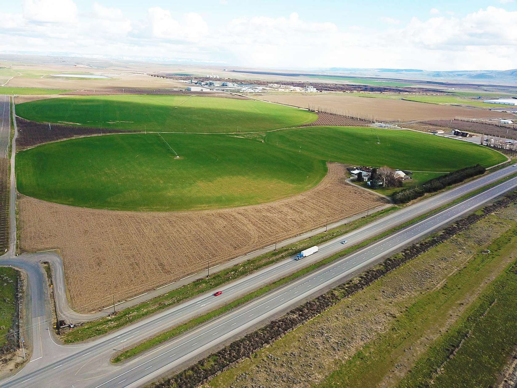
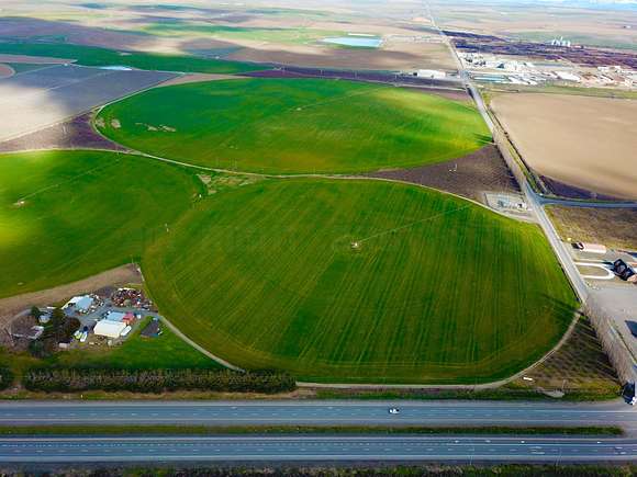
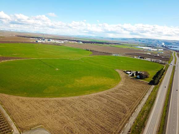
This property lies in the midst of the area known as the Wallula Plain where the warm air currents flow up the river through the Wallula Gap. There is a total of 312 acres; however, Seller will consider keeping 87 acres with the dwelling, shop and two small pivots to the west of the powerline crossing, leaving about 225 acres. This land is surrounded by tree fruits and row-crop plantings. It is one of, if not the earliest, harvest areas for cherries. The black sand soil encourages earlier harvest for row crops. The warm air currents coming off the river create warmer winters and cooler summers in the area. The land is suitable for double-cropping with short season crops like peas and sweet corn. There is a 40's-built "Alphabet House" from Richland, a metal shop and lean-to for structures.
TREE INFORMATION: There are 35+/- acres of cherries. Chelans have 22 acres and Bings are 14 acres. They are primarily Chelan with Van pollinators. The Bing block has Rainier pollinators. One block of Chelan has both Van and Index for pollinators. All are on Mazzard root stock. First planting was in 1988, and the last planting was in 2007. The spacings will vary depending upon the year planted. Bings are 18 x 22, Chelans are spaced differently in each block. The blocks are 18 x 16, 18 x 12, and 14 x 12. Pack-outs are included in this package.
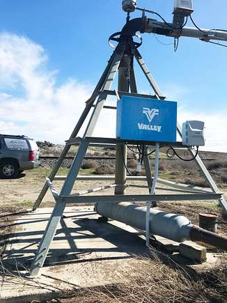
IRRIGATION EQUIPMENT: Pivots are all Valley Irrigation. They are original equipment and well-maintained. The large pivot is a 1975. The two east of the house are 1978 and 1979. The wipers are 1980 models. The pumps for the three full pivots are a 1975 model 75 hp and a 2016 50 hp VSD. The pumps for the wipers are two 30 hp and a 2015 model 40 hp VSD. Mainline are all PVC with sizes between 10-inch to the big circle, 6 and 8 inch to the feeders and 5 and 6- inch to the North parcels.
WEATHER STATION is a MET-1 air monitor. It has two thermometers, one for high air temps and one for ground temps and one for upper air temps. It measures temperatures, humidity, barometric pressures, and changes and has capacity for other measurements. It is connected via a cellular plan for annual fee of $120.
UNDERGROUND LINES: NATURAL GAS and PETROLEUM PIPELINE:
There is a buried natural gas pipelines running through the property serving AmeriCold and Tyson Foods to the southeast. There is a buried petroleum line that crosses diagonally through the property, also. (see schematic)
PROPERTY SIZE:
The total is 312 acres of farm land. Approximately 35 acres is in mature cherry trees. The remaining row crop acreage is rotational plantings of mostly vegetables or potatoes. Some of the crops are suited for double cropping with short season maturity crops like processor peas or sweet corn. Typical rotation could be: potatoes or carrots followed by a double crop season of peas and sweet corn, then grain and processor beans; and back to a root crop or onions and repeat.
ROADS:
The property lies parallel to US Hwy 12 (a 4-lane freeway) and is sandwiched between the state highway and a Union Pacific Railroad line. There is access from both the north end and the south end onto county roads, Dodd Road and Iverson Road, one paved and one gravel.
IRRIGATION:
Irrigation water is served by South Columbia Basin Irrigation District (SCBID), a subsidiary of the Bureau of Reclamation's Columbia Basin Project. Much of the land lies in Irrigation Blocks 2 and 3. The small parcels acquired from UPRR are under Water Service Contracts; however, the majority is 'durable water' that cannot be severed from the land. Annual charge for 2023 was $27,250 for the farm.
POWER:
Electrical power comes from Pacific Power and Light, a subsidiary of Bonneville Power Assn (BPA). There is 3-phase power serving the property for pumps.
UTILITIES:
The home and shop are served by a domestic well and septic system. Garbage service is available in the area.
NEIGHBORHOOD:
Dodd Road on the south boundary has a C-store/gas station at the corner of Hwy 12. This road is the main access to AmeriCold, Simplot Feedlot and Tyson Foods Packing plant, and is heavily travelled. To the north is FlatTop Ranch (an apple ranch) and Monson Fruit Farm. Across the RR tracks is open row crop land where potatoes, sweet corn, peas and other processing foods are raised. In the rotation will likely be some alfalfa, wheat and beans. To the west is the Two Rivers wildlife Preserve and the Columbia River.
CROPS:
The warm air currents close to the river are optimal for short season processor crops like green beans, peas, sweet corn, peppers and cucurbits. Rotational crops for soil care are potatoes, onions, carrots and grain or grasses. The longer and earlier growing season makes the land well-suited for early fruit. The corners of the pivots are in several varieties of cherries.
EQUIPMENT:
Included will be the pumps, electrical panels, buried mainlines, pivots and existing ponds. Pivots are Valley systems, and appear to be several years old, but functional. They do not appear to have electronic management systems on them. There is surface mainline and handlines for the corners that are negotiable via Bill of Sale as they are considered personal property and taxed as such. There are 7 propane powered wind machines in the orchard plots that are included in the sale. The propane tanks are leased, and leases are usually transferable.
TREES:
The pivot corners are planted to several varieties of cherries. All are on Mazzard root stock. Most of them are Chelan with Van pollinators. One block is Bing with Rainier pollinators. There is one block with double pollinators. Trees were pruned critically the 2022-23 winter, thus minimizing the harvest for 2023. Pruning for 2024 has not yet started, but is on the schedule.
INFRASTRUCTURE:
There is a weather station at the SE corner of the property (the highest point on the farm) for monitoring temperatures, barometric pressure, humidity, and winds. Multiple pumping stations and irrigation delivery ponds are located strategically throughout the property. Concrete irrigation canals are owned and maintained by SCBID, the irrigation company. Cascade Natural Gas has two (2) pipelines crossing the property for delivery to Americold, Simplot and to Tyson Foods Packing Plant. These are buried deep and have recorded easements for them. Overhead power lines cross through the property north to south to the pumping stations. And some power lines follow portions of the perimeter of the property. UPRR line runs parallel to the East boundary and has a debris fence for part of the way towards the northern end of the property. There is a buried petroleum line crossing the property, also.
Location
- Street Address
- 35032 W Highway 12
- County
- Walla Walla County
- Elevation
- 367 feet
Property details
- Date Posted
Resources
Listing history
| Date | Event | Price | Change | Source |
|---|---|---|---|---|
| Aug 31, 2024 | Under contract | $10,000,000 | — | Listing agent |
| Mar 19, 2024 | New listing | $10,000,000 | — | Listing agent |
